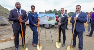
Norfolk has the East Coast’s fastest sea-level rise rate, and Virginia International Gateway and Norfolk International Terminals are on the front lines of the environmental threat. Photo courtesy Port of Virginia
Norfolk has the East Coast’s fastest sea-level rise rate, and Virginia International Gateway and Norfolk International Terminals are on the front lines of the environmental threat. Photo courtesy Port of Virginia
Rising alarm
Sea-level rise among port’s concerns
Over the years, scientists have warned about sea-level rise, especially in Norfolk, which has the highest rate on the East Coast.
“Norfolk is very flat. When you see a small increase in water levels, a wide part of land floods in response,” says Molly Mitchell, a researcher at the Virginia Institute of Marine Science, which issues annual sea-level report cards for 32 coastal communities in the United States.
Hampton Roads as a whole will probably see between 1 and 3 feet in sea-level rise by 2050, according to the National Oceanic and Atmospheric Administration (NOAA), and Mitchell says that’s just the beginning. “Change [in the rate of sea-level rise] is happening more rapidly. Between 4 and 6 feet of sea-level rise by 2100 is considered pretty likely.”
It’s hard for non-scientists to picture the overall impact of oceans even a foot above where they are now, but researchers recently produced the Global Maritime Trends 2050 report, which forecasts that about a third of the world’s 3,800 ports will be unusable by 2050 due to sea-level rise — particularly those in Houston, Shanghai and Mexico. The report, which was produced in collaboration with Economist Impact, recommends that ports step up efforts to decarbonize and boost infrastructure resilience and efficiency.
While the Port of Virginia was not singled out in the report, Norfolk International Terminals, its largest maritime facility, is vulnerable to storm surge flooding. Mitchell contends that everything on land at the port has the potential to flood, including buildings and roads leading to the port.
“Part of the solution is to identify where the problems could occur and look at ones that are easily fixed, such as raising low-lying roads on the way to the port,” she says. “Flooding is not just an issue for the Port of Virginia, but sea-level rise is higher at the Port of Virginia than at the Port of Charleston, so they will have to deal with that sooner.”
Officials at the Port of Virginia say they’re working on the issue, although so far, sea-level rise has not raised significant concerns among port customers.
“That’s not to say that we don’t take sea-level rise seriously,” says Cathie J. Vick, the port’s chief development and public affairs officer. “Our assessment is that sea-level rise will have minimal impacts on our operations because there is already ample space between the projected median high-tide line and the decks of our berths. We currently do not experience tidal flooding at our terminals, but from time to time may have standing water from prolonged rain events.”
After conducting critical infrastructure surveys, port officials raised power stations to protect them from flooding events, such as sea-level rise, tidal surges and torrential rain. “We have very specific construction guidelines to ensure our investments will remain viable over the long term,” Vick says. “We are very fortunate because we are not in a position to have to begin planning a retreat from any of our terminals or offices.”
Instead, the port is focused on slowing climate change and its effects, such as sea-level rise. According to NOAA, moving to more renewable energy sources is starting to slow sea-level rise. “We have committed to becoming a net-zero [carbon] operation by 2040 and are taking deliberate actions to use clean fuels to move cargo and power our operations,” Vick notes.
This year, the port became the first major U.S. East Coast port to run its entire operation from all carbon-free energy sources. The power purchase agreement with Dominion Energy, in cooperation with Rappahannock Electric Cooperative, will allow the port to offset its carbon footprint by reducing carbon emissions 45% per container.
“From the big ship-to-shore cranes to the forklifts in the shops, more than 50% of the equipment we use is electric or hybrid-electric,” Vick says. “This effort and investment will continue until we have hit our 2040 goal [of becoming carbon neutral].”
Plans in place
In addition to the port, the cities of Norfolk and Virginia Beach are also fully involved in flood management to protect their assets.
The issue is particularly acute in Norfolk. With Norfolk’s risk of flooding and damage from coastal storms on an upward trajectory, the city and the U.S. Army Corps of Engineers are collaborating on the Norfolk Coastal Storm Risk Management Project, a combination of structural, nonstructural and natural measures to counteract flooding that will be implemented over the next decade. Known as Resilient Norfolk, the
$2.6 billion project includes storm-surge barriers, almost 9 miles of floodwalls and levees, 11 tide gates and 10 pump stations, as well as home elevations, basement fills, oyster reefs, wetlands mitigation and living shorelines.
“We have $40 billion worth of real estate in the city, including the Port of Virginia, the Naval Base, universities and the region’s only Level 1 trauma center, that will benefit from these measures,” says Kyle Spencer, Norfolk’s chief resilience officer. “For every $1 million we do in flood projects, we will typically see $6 million back in benefits.”
The city will fund 35% — or $931 million — of the project, while federal funds, including $400 million awarded through the Bipartisan Infrastructure Law, will pay for 65%.
Gov. Glenn Youngkin included $73.85 million for Resilient Norfolk in his 2024 budget, but the General Assembly reduced that allocation to $25 million, although the state’s 2024-26 budget won’t be finalized before mid-May at the earliest.

“We’re working with the governor’s office to find additional state funds,” Spencer says. “That’s a continuous effort, but the cost of not doing anything is far worse. It’s not just about property damage. There’s a huge amount of risk to personal safety.”
Currently under design, the first phase of Resilient Norfolk will include a system of floodwalls with a levee and surge barriers from downtown to Ghent. Construction of a downtown floodwall is slated to be completed in the early 2030s. In the second phase, floodwalls and barriers will be installed to decrease storm surge from entering Pretty Lake at Shore Drive. The design portion is expected to get underway this year, with construction continuing through early 2028.
Flooding impacts at the port will be addressed in phase three when a storm surge barrier will be installed from Norfolk International Terminals (NIT) to Lambert’s Point, where construction of the Fairwinds Landing maritime operations and logistics center is underway. Construction on the storm barrier, meanwhile, is expected to begin in late 2027. The city is also working with the port to develop shoreline projects to mitigate wave activity against NIT.
“That will be designed to stop catastrophic flooding from going into the Lafayette River and flooding Hampton Boulevard and key port assets,” Spencer notes. “The port is a working waterfront, so we can’t really put a floodwall up, but we can raise equipment off the ground and build deployable floodwalls to put in place before storms and put them around critical equipment like water pump stations and electric substations.”
Phase four will include construction of floodwalls, storm surge barriers and tide gates to diminish storm surge from entering Broad Creek at I-264. In the final phase, homes and other structures will be elevated and basements filled in flood-prone areas of the city, including southside Norfolk and Willoughby.
After residents in some of those areas questioned why their neighborhoods would not be protected with floodwalls, the city asked the Army Corps of Engineers to re-evaluate the plan. The reevaluation will take three to five years at a cost of $4 million to $6 million.
Spencer notes that Resilient Norfolk, while accounting for sea-level rise, is primarily designed to deal with catastrophic storms. “We’re overdue for one of these large storm events,” he adds. “We’re seeing the environment changing and rainfall happening at a faster rate, and we need to adapt.”
Flooding makes beachhead
Resilience is also a priority in Virginia Beach where high tides in low-lying areas can lead to flooding even on sunny days, a situation known as recurrent flooding. In 2021, voters overwhelmingly approved a $568 million bond referendum to install tidal gates at West Neck Creek, the Lesner Bridge, Rudee Inlet, Elizabeth River and Back Bay, pump stations and pipes to improve stormwater drainage and minimize inundation from heavy rains and tidal flooding, and restoration of the Elizabeth River shoreline. The 10-year plan also includes about
$2.6 billion worth of improvements, from elevating roads to converting the 100-acre Bow Creek Municipal Golf Course into a stormwater park to mitigate flooding in surrounding neighborhoods.
In addition, Virginia Beach plans to construct a marsh terrace on Back Bay to restore about 300 acres of wetland lost over the last 350 years. Designed to prevent erosion, the berm will be the first of its kind on the East Coast.
“They’ve done a lot of these on the Gulf Coast, but it’s never been looked at before on the East Coast,” says C.J. Bodnar, technical services manager for the Virginia Beach Stormwater Engineering Center. “It will recreate lost wetlands and could lead to a slight reduction in flooding.”
Along with the bond referendum, Virginia Beach has obtained more than $40 million in grants. “We continue to look for state and federal grants to help with the cost of these projects,” says Mike Tippin, the stormwater engineering center’s administrator.
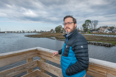
Despite the costs, Tippin and Bodnar stress that the city cannot put off addressing sea-level rise.
“If we don’t do anything, we’ve got the city of Virginia Beach becoming the island of Virginia Beach,” Bodnar says.
Overall, Virginia has led the Southeast U.S. in adapting to climate change, but there’s still much to accomplish, says Jessica Whitehead, executive director of Old Dominion University’s Institute for Coastal Adaptation and Resilience. “The state has been moving forward and taking action despite not having endured a major storm to force everyone to the table. That says something about the scale of climate change — that we have so far to go.”
Whitehead adds that multiple strategies are needed to address sea-level rise and other climate change issues and build resilience. “There’s never a single project that will fix 100% of the problems. You have to figure out the menu of options and choose what’s feasible depending on how much funding you have.”
This story has been updated since publication.
t


